
Update: 14.07.2026
Typhoon Bavi has weakened to a tropical storm and continues to lose strength as it moves inland across eastern China.
Kuehne+Nagel reports that local authorities have ended Level II typhoon emergency response measures in Ningbo and Shanghai (Yangshan), while transport and logistics activity has largely returned to normal.
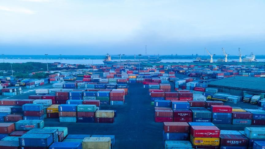
Port and terminal operations in Ningbo and Shanghai resumed on 13 July, alongside container yard activities. Similarly, operations in Qingdao Port have resumed to normal today around noon local time.
East China trucking services are now fully operational, and warehouses in both locations have resumed normal operations. Multiple barge terminals have also restarted operations.
The update follows Bavi’s landfall in Zhejiang province on 13 July. Although the storm weakened after coming ashore and continued to weaken as it moved into Anhui province, its extensive rain bands remained spread across eastern China.
Meteorologists warned that heavy rainfall could continue to affect several provinces, including Liaoning and Jilin, as the system tracks north-eastwards.
For the latest port and vessel statuses or situation updates, please refer to the seaexplorer alert map.
Update: 13.07.2026
The ports of Ningbo and Shanghai in China started resuming operations gradually on 13 July, after typhoon Bavi prompted several container terminal closures.
Qingdao Port also faced suspended operations on 12 July, with additional work stoppages planned in Qingdao bonded warehouses as of 13 July 17:00 local time.
At the time of writing this article, container yard, warehouse and trucking operations at Ningbo and Shanghai are reported as operational.
In addition, operations at some barge terminals have started resuming today, including Taizhou and Jiaxing.
While authorities have reduced the emergency response level in parts of China, rainfall and strong winds are still expected in the East China Sea as well as coastal areas in Taiwan and the Philippines in the next few days.
According to Chinese media, Xinhua, the storm will transition into an extratropical cyclone after Wednesday.
Typhoon Bavi caused mass evacuations over the weekend, with authorities evacuating nearly two million people in the storm’s path.
More information is available in our latest advisory.
Update: 11.07.2026
Typhoon Bavi has prompted further escalation of emergency measures in East China, with authorities raising the typhoon response level to Level I in Ningbo and Level II in Shanghai (Yangshan) as of 11 July.
Operations have now been suspended at Ningbo port terminals, Shanghai Yangshan terminals and Shanghai port Waigaoqiao terminals.
Ningbo container yards have halted activities, while Shanghai container yards are scheduled to suspend operations on 11 July.
Ningbo warehouses are also suspended, although Shanghai warehouses and East China trucking services remain operational. More information is in our latest advisory.
Several barge and feeder locations across the region, including Taizhou, Jiaxing, Zhenjiang, Taicang, Nantong and Changshu, have reported operational suspensions.
For the latest port and vessel statuses or situation updates, please refer to the seaexplorer alert map.
Update: 10.07.2026
Typhoon Bavi has triggered tighter emergency measures across East China, with authorities upgrading the typhoon response level to Level II in Ningbo and Level III in Shanghai (Yangshan) as of 10 July.
Ningbo port terminals are scheduled to suspend operations from 12:00 on 10 July, while Ningbo container yards are expected to halt activities later the same day.
Warehouse operations in Ningbo are also set to be suspended on 11 July, and additional disruptions have been reported across regional barge and feeder networks.
In contrast, Shanghai port terminals, container yards, warehouses and East China trucking services remain operational.
In Taiwan, Bavi is forecast to bring severe weather conditions with maximum sustained winds of 184kph and a storm field large enough to cover all of northern Taiwan by midday on 11 July.
Authorities have warned of strong winds, rough seas and extremely heavy rainfall as the typhoon approaches, with waves expected to exceed six metres in some coastal areas.
According to Lloyd's List, Kaohsiung Port issued a notice on Friday ordering container ships and bulk carriers above specified tonnage thresholds required to leave by 2200hrs.
Meanwhile, Taichung port announced suspended inbound and outbound vessel movements effective on July 10. The ports of Keelung and Taipei are expected to halt operations as well.
For more information, please check our latest advisory or contact your local Kuehne+Nagel representative.
Update: 09.07.2026
Typhoon Bavi continues to advance towards East China, prompting updated emergency measures in key coastal locations.
On 8 July, authorities in Ningbo reduced the typhoon emergency response to Level III, while Shanghai (Yangshan) adjusted its response to Level IV.
At the same time, Ningbo and Shanghai port terminals, container yards, warehouses and East China trucking services remained fully operational.
However, some downstream barge facilities have announced operational restrictions, including Zhapu, Zhenjiang, Taicang and Nanjing. More information is available in our latest advisory.
The typhoon is also expected to impact locations in Vietnam and Taiwan in the next few days.
Taiwan has already taken precautions to restrict operations in the maritime industry, mainly related to ferry and passenger activities. No reports about suspended operations in container terminals were announced.
In Vietnam, the primary risk at present is likely to include deteriorating marine conditions in the East Sea due to high winds and 3–5 metre waves, which could affect maritime operations.
Update: 07.07.2026
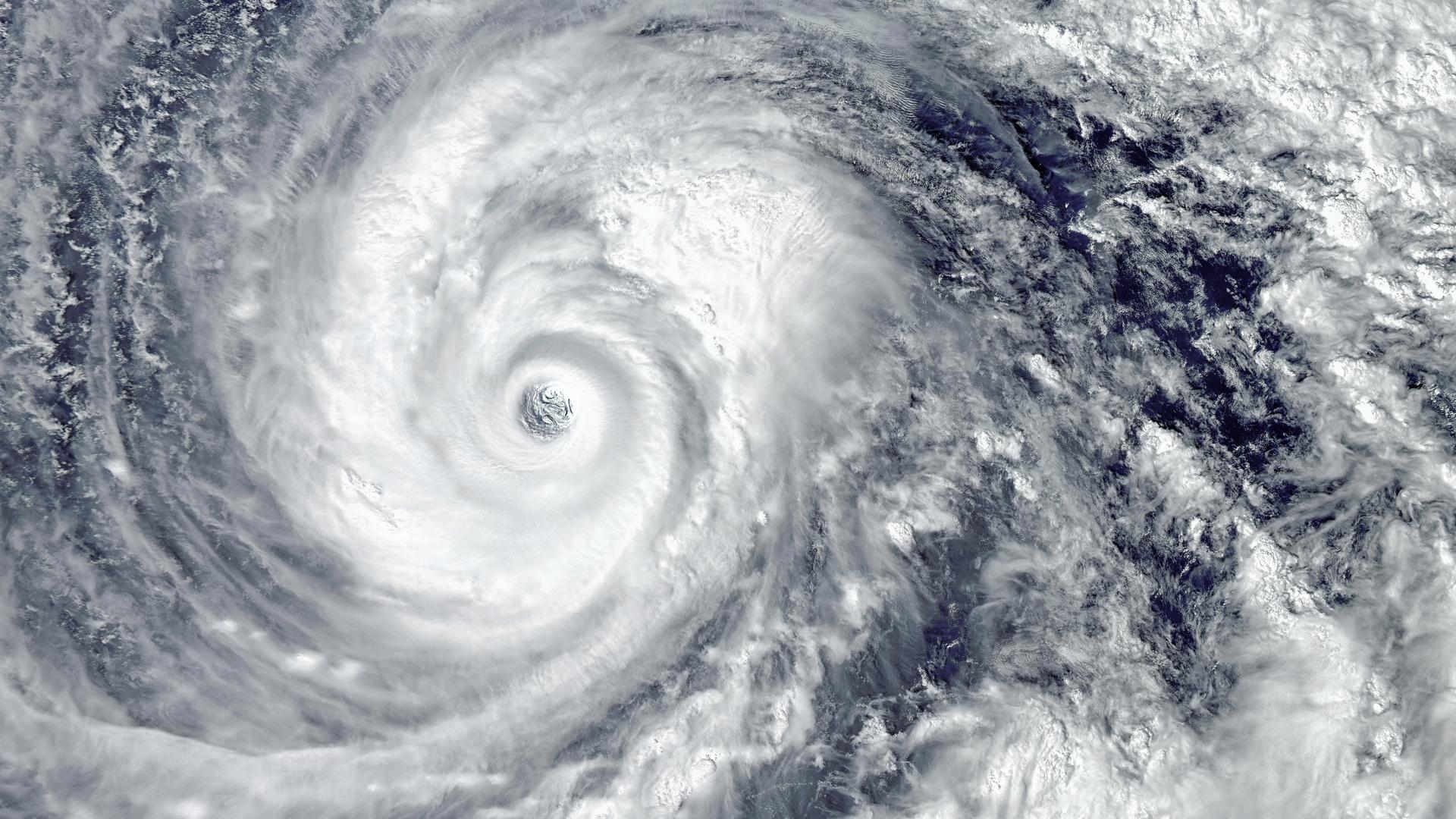
Super Typhoon Bavi has moved closer to East Asia after making landfall on the US territorial island of Rota in the Northern Mariana Islands on 6 July.
According to the US National Weather Service, the storm crossed the island with winds exceeding 150 mph and brought heavy rainfall to the Northern Mariana Islands.
As of 7 July, forecasts indicate that Bavi is expected to maintain super typhoon intensity for a further two to three days before gradually weakening from around 10 July.
In the Philippines, the storm continued moving west-northwest across the Philippine Sea and is expected to enter the Philippine Area of Responsibility between the evening of 7 July and the early hours of 8 July, when it will be assigned the local name Inday.
The system was reported with maximum sustained winds of 205 km/h and gusts reaching 250 km/h. Although the likelihood of landfall over Luzon remains low, tropical cyclone wind signals may be issued for parts of northern and eastern Luzon.
Vietnam’s National Centre for Hydro-Meteorological Forecasting reported that Bavi weakened by one category on the national wind scale on 7 July but remained a super typhoon.
Forecasts indicate that the storm will continue westward before turning west-northwest towards Taiwan around 9 July. Current projections show the system passing north of Taiwan around 11 July before reaching Fujian Province on China’s southeast coast around 12 July.
China is also facing severe weather conditions away from the typhoon’s projected path. Thunderstorms in Hubei Province caused at least eight fatalities after strong winds affected several cities on 6 July.
Authorities have warned that parts of Guangxi, Jiangsu and Shandong could receive up to 260 mm of rainfall over the next 24 hours, while other regions may experience tornadoes. The heavy rainfall is raising concerns for agricultural areas in Hubei and Shandong.
Ports in the affected locations are likely to witness disrupted operations and reduced capacity. For the latest port and vessel statuses or situation updates, please refer to the seaexplorer alert map.
Original article: 02.07.2026
Two tropical storms are developing across the western Pacific, with forecasts indicating stronger winds and broader impacts over the coming days.
Typhoon Bavi, also called Typhoon No. 9, was identified near the Marshall Islands on 2 July. Forecasts indicate that the system is moving towards the East China Sea and could become a Category 5 super typhoon on 5 July.
The US Navy’s Joint Typhoon Warning Centre said that wind speeds could exceed 260 km/h during the five-day outlook period as the storm moves across the Mariana Islands.
According to Chinese media Xinhua, authorities have already launched a Level-IV flood control and typhoon prevention response in Hainan, Guangxi and Guangdong.
The tropical depression over the South China Sea is forecast to make landfall along the coast between Guangxi and northern Vietnam on 4 July. Heavy to extremely heavy rainfall is expected in parts of the affected areas through 5 July.
Ports in the region, including the ports of Ningbo and Shanghai, could face interrupted operations as a result.
A separate system, TEN-26, remains under observation between China and Vietnam. The storm is expected to strengthen between 2 and 4 July, with peak impacts forecast on 4 July.
Maximum wind speeds are projected to reach 74 km/h, while Vietnam is assessed as having high vulnerability.